Contents
Do you know about Naver Map which is the most popular navigation app in South Korea?
The most famous navigation app around the world is Google Maps. It provides information about your location and even the public transportation system, everywhere and anytime. In South Korea, however, ‘Naver map’ is the most popular navigation app. It offers comprehensive information about locations and the public transportation system, making it widely used across the country.
Then what’s the feature about Naver map? and how do you use it? In this article, I will show you about general usage of Naver app.
The reason why Google Map isn’t popular in South Korea.
Why isn’t Google Maps a popular app in South Korea? It’s related to homeland security. Since the 1950s, Korea has been divided into two countries, North and South Korea. Nowadays, South Korea is in a peaceful era, but it is technically still at war. That’s the reason why the government of South Korea restricts Google from accessing specific geographic information.
Strictly speaking, Naver Maps doesn’t have as many useful functions as Google Maps, but for the reasons mentioned above, it’s better to use when traveling in Korea.
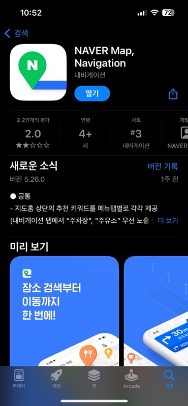
Let’s search for “Naver Map” in the App Store or Google Play Store. You can discover green icons like this. You might wonder why the evaluation score is so low, but it seems to have occurred because many Koreans are strict about their ratings. Nonetheless, this app is still useful in South Korea despite its rating score.
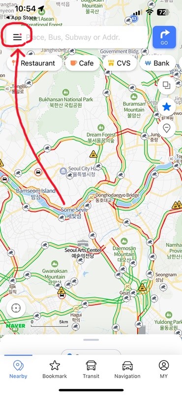
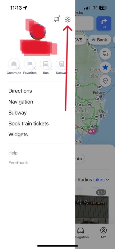
Naver Map supports languages other than Korean such as English, Japanese and Chinese. Let me show you how to set the language.
First, find the menu button on the left side of the search bar and setting icons.
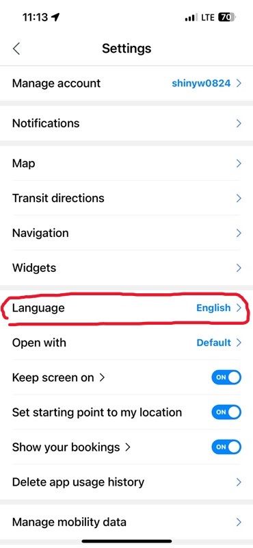
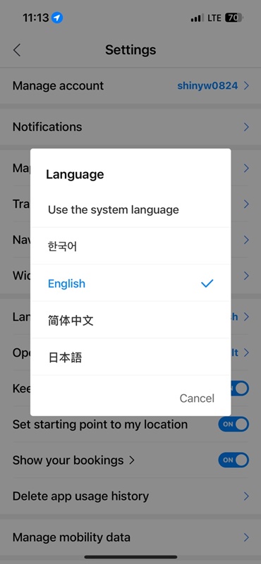
And touch the ‘Language’ menu, then you will get access to the setting for other languages. It doesn’t support as many languages as Google Maps, but it works well with English. Change languages here, and start using the map!
Naver map has many functions, but they typically have the following functions.
- Public transportation in South Korea includes inter-city buses, trains, subways, and more.
- Road view
- Bicycle route
- Many blog reviews from local people (Such as Restaurants, convenience facilities)
1. Public transportation
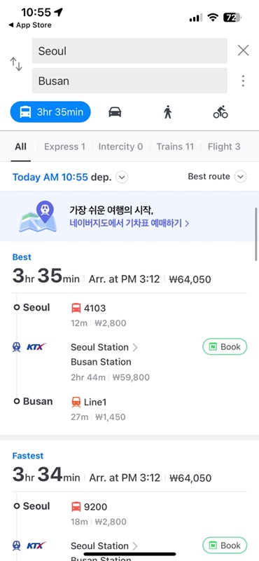
It has similar features to Google maps, but it has better or worse features compared to it. The function of showing public transportation routes is not much accurate compared to Google Maps used in other countries. But still it’s a level that can be used to some extent in Korea, so try it. Set the route from your current location to your destination, and it will show you the routes with transportation options.
2. Road view
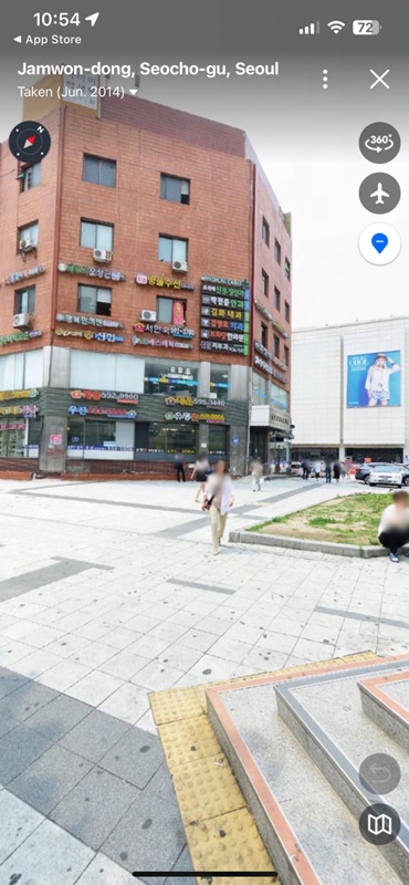
The road view option is more accurate and powerful than Google Maps. When you come to travel in Korea, road view can help you with your travel plans. It shows both past and current information about the location you want to know about.
3. Bicycle routes
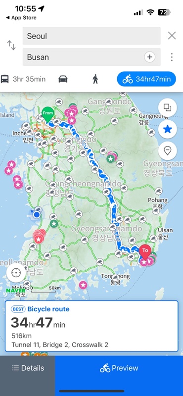
Do you like to ride a bicycle? It supports routes not only for cars, but also for bicycles. You can access roads for riding bicycles, even on narrow roads where cars can’t pass with this Naver maps. owadays, many foreigners come to South Korea to ride bicycles. I see them everywhere, even in the countryside far from Seoul.
4. Many blog reviews from local people (Such as Restaurants, convenience facilities)
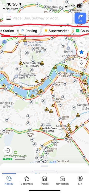
Before you get to the traveler’s spot, you can see information about reviews from Koreans. Many blogs connected to Naver Maps, serviced by Naver, contain valuable insights. However, Naver blogs run by Koreans are hard to search for using Google. Don’t worry about Korean words. With a smartphone, you can easily translate Korean to English or your native language.
Not even like Google Maps, but Naver Maps provide useful information for traveling in South Korea. With this map, you’ll never get lost, even if it’s your first visit to Korea. Be brave and trust this app.
Read other articles about south Korea